Last weekend I went on a day trip through a part of Washington (and Oregon) I've never been to. Even with as often as W and I try to get out around the area, there are still great swaths of land left unexplored by us. We're going to try to remedy that this year.
 |
| a 4-mile-long bridge spans the Columbia |
Bridges were a main focus of this off-the-cuff trip. I read about the
Astoria-Megler bridge, which is the longest continuous truss bridge in
North America, spanning the great Columbia River, and decided that I
ought to go see it.
I also found out about the Grays River bridge, the only covered bridge left in the state. It was right along my way!
The last couple years I lived in Michigan, I lived near a rather long covered bridge. It was nice to see another one.
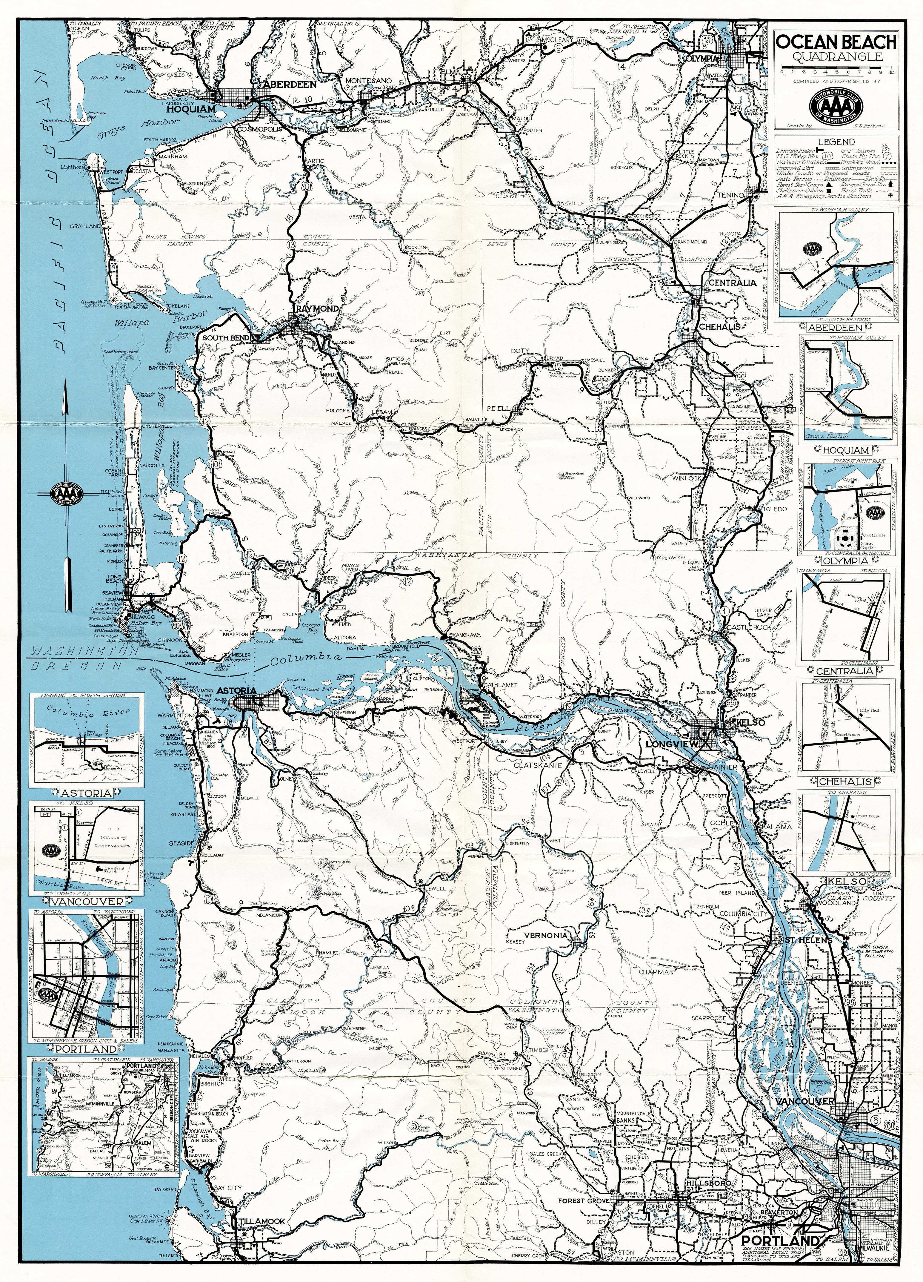
Just yesterday I came across a really wonderful old map of the very area covered in this trip, published by the Automobile Club of Washington in 1941. I've highlighted certain travelled parts, and it's interesting to see how much of the infrastructure we enjoy now didn't exist then. The Columbia River bridge hadn't been built yet, and neither had part of the road clinging to the edge of the river leading up to it. It was proposed at the time, but took more than a few years after this map was printed to actually be built. Most of the highway numbers are also different now.
I wasn't able to get the best photos of the bridge due to a typical early summer haze on a hot day (for the Pacific Northwest, at least, it was over 70°F)
The Oregon side has the most famous and picturesque part of the bridge, but we have a rather nice section in Washington territory.
There was also a view of Mount Saint Helens.

Here is a closer look at the bridge from the Astoria waterfront.
I travelled further south until I got to Gearhart where I pulled off at a lovely beach park. In Washington, we don't typically have sand dunes and grass like this, so it reminded me of Lake Michigan.
Tillamook Head, which shares its name with the famous dairy land. The whole area around the Columbia River mouth has a fair amount of dairy farming. The Oregon section is more "tamed", but the Washington side is a fascinating mix of forestry, big hills, and a very western atmosphere, combined with picture-perfect red barns, pastures, and a covered bridge.
After Gearhart, I drove back north again, crossing the bridge and heading along US-101. I drove through the lovely Willapa Bay wildlife refuge before getting to South Bend and Raymond, which from a distance have the look of a Scandinavian fishing village but up close look like any drab little town that's seen better days.
Driving back towards the ocean along a road which didn't exist in 1941, I got to Westport and saw its lighthouse.
You can see that the ocean has an entirely different character here just a short distance north, though there are still some grasses, it has more scrub and feels more evergreen, northern, and "Washington".
There were some lovely colors.
The lighthouse was mostly hidden by a young forest.
Unlike the sad affair that the lighthouse north of Tacoma is, this was a good, proper old lighthouse.
I then drove north to Aberdeen to see the fascinating heel-trunnion bascule bridge over the Wishkah River. (sorry, no pictures, but it's worth looking up! I was also recording a lot of video along the trip and some of my best footage is on tape rather than photos)
Aberdeen has some really fascinating infrastructure and I always love visiting the city. Aside from some interesting bridges, there is a main rail line running right through the center of town on the main street, and a delightful little 6' 6" high underpass under a rail bridge on a minor street.
I drove up into the higher elevations of the city and took a few nice pictures of the city. This section is tricky to get to, but I managed to find a nice view.
Though nothing near as exotic as Scott K's trips to Hong Kong, and honestly not even one of the more exciting trips I have documented here on my blog, I love this part of the country. It's special and hard to describe well in words or photos.
 |
| click to view full detail |
I posted more about this map
on my tumblr with a link to the full size, as well as some commentary and close-ups.